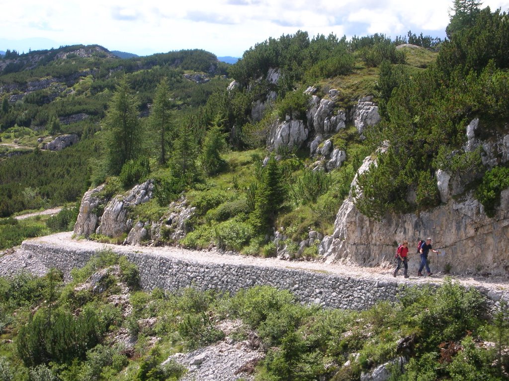
Experience nature in Bassano del Grappa
 Nordic Walking Bassano - www.nordicwalkingbassano.it
 Cai Bassano del Grappa - Via Schiavonetti, 26 - Bassano del Grappa - Tel. 0424.227996 - www.caibassanograppa.com
 Cai Marostica e Sandrigo - Corso Mazzini, 10 - Marostica - Tel. 0424.470952 - www.caimarostica.it
Experience nature in Recoaro
Hikers and walking enthusiasts will have the chance to live incredible experiences in Recoaro and can try out some Nordic Walking too! www.nordicwalkingrecoaro.org


For more information and the complete map of the routes:
IAT Recoaro tel. 0445/75070
Experience nature on the Asiago-Plateau

After winter, when dandelions bloom and dye the meadows of the Plateau yellow, it is the perfect time to go hiking: there are many different routes, some of them are even linked to the events of the First World War (1915/18). Among the many itineraries, the most interesting ones are: Mount Ortigara (the Alpinos’ sacred place), Cima Caldiera, Fort Corbin and the galleries of Mount Cengio, the cemeteries of Magnaboschi valley, Mount Fior and Castelgomberto. More routes are: Marcesina plain, Fort Lisser in Enego, Fort Campolongo in Rotzo.
In addition to the most challenging routes on the locations where the Great War took place, the Plateau also offers short panoramic walks on easy paths surrounded by nature, of different length and difficulty, suited for families and for all ages.
To learn more about all the paths, visit the website of the C.A.I. Asiago Plateau and the 7 Comuni CAI ASIAGO 7 COMUNI
 NORDIC WALKING
Thanks to its geographic conformation, the territory of the Asiago Plateau is perfect for Nordic walking, an active walking technique with sticks.
This healthy outdoor discipline helps toning up the musculature without causing fatigue on the joints and is suited for anyone and any age.
There are many offers from the local associations
![]() Nordwalk asd cell. 348.7817707 - www.nordwalk.it
Nordwalk asd cell. 348.7817707 - www.nordwalk.it
 Biketrekking cell. 348.2904409 - www.biketrekking.it
 Guide Altopiano cell. 3407347864 www.guidealtopiano.com
![]() Telemark 7 Comuni cell. 3474300225 www.telemark7comuni.com
Telemark 7 Comuni cell. 3474300225 www.telemark7comuni.com
Experience nature in Tonezza
1. EXCALIBUR ROUTE
ALTITUDE DIFFERENCE: 40 metres
REQUIRED TIME: two and a half-hour roundtrip
RING LOOP: 2,5 Km
DIFFICULTY: easy
STARTING POINT: lodge "La pontara"
An educational-naturalistic route on a natural preexisting path with special locations for the study of the morphological characteristics of the territory and its traditions. It is also partially accessible for visitors with disabilities.
2. FOGAZZARIANO ROUTE
ALTITUDE DIFFERENCE: 100 metres
REQUIRED TIME: 2-hour roundtrip
DIFFICULTY: easy
STARTING POINT: in front of Ex Villa Roi
Educational and artistic route, dedicated to Antonio Fogazzaro, who was inspired by those very same places to write the sixth chapter of his novel “Piccolo Mondo Moderno”.
3. PATH TOWARDS MALGA ZOLLE DI DENTRO
ALTITUDE DIFFERENCE: 250 metres
TIME REQUIRED: two and a half-hour roundtrip
DIFFICULTY: easy
STARTING POINT: from Contrà Sella (1080m)
Leg at the fountain “ai Canali” (Contrà Valle)
Path that winds half on asphalted road, half on gravel road. There is the chance to reach Mount Toraro and/or Campomolon from the cottage.
4. TRONCONI ROUTE
ALTITUDE DIFFERENCE: 600 metres
REQUIRED TIME: three and a half-hour roundtrip
DIFFICULTY: intermediate
STARTING POINT: from Contrà Sella – 150 metres from Filò café, on the left.
Old historical path that climbs up to Mount Spitz, partially passing through Vena di Sotto road and signposted CAI 537. Going back to the path, it is possible to pass through Vena di Sotto road, then, while going downhill, at the first hairpin turn follow the old stretch through the forts of Tarbisa hill (which have not been fully restored yet).
5. PATH TOWARDS CONTRA' FONTANA AND CONTRA' VIA
ALTITUDE DIFFERENCE: 100 metres
REQUIRED TIME: one and a half-hour roundtrip
DIFFICULTY: easy
STARTING POINT: from Contrà Grotti, it is possible to venture into a beech tree wood, taking the same old paths that were once used for transporting wood and mushrooms to Contrà Via la Foiba della Rosetta.
6. FONTANELLE ROUTE
ALTITUDE DIFFERENCE: 50 metres
REQUIRED TIME: 1-hour roundtrip
DIFFICULTY: easy
STARTING POINT: from Contrà Via
Educational-naturalistic path, with several illustrative notice boards with a fork leading towards the centre (Via del Partigiano) and Contrà Pettinà.
7. PATH TOWARDS VALLE DI RIO FREDDO
ALTITUDE DIFFERENCE: 400 metri
REQUIRED TIME: 3-hour roundtrip
DIFFICULTY: intermediate
STARTING POINT: from Contrà Vallà – through “Valle della Sola” path CAI 539
Possibility of tasting of trout at the Trattoria "Alla Fortuna"
Military path, hikers can go back by passing through Valle di Rio Freddo and arriving in Contrà Valle, path CAI 538.
8. BOSCATI ROUTE
ALTITUDE DIFFERENCE: 300 metres
REQUIRED TIME: 4-hours roundtrip
DIFFICULTY: intermediate
STARTING POINT: from Contrà Sarcello – between the camping and Contrà Sarcello path CAI 536
Old path used during the Great War (1915/1918) along with trenches and battlefields.
There is the chance to go back using the asphalted road and arrive in Contrà Campana.
9. PATH TOWARDS MONTE CAVIOJO BIVACCO VETTORI
ALTITUDE DIFFERENCE: 250 metres
REQUIRED TIME: 3-hour roundtrip
DIFFICULTY: high, with the chance to travel through a short iron path.
STARTING POINT: Mount Cimone square, path CAI 542
There is the chance to return passing through the military gallery on Cima Neutra. In this case it is necessary to bring a flashlight.
10. PATH TOWARDS CIMA PAILE
ALTITUDE DIFFERENCE: 100 metres
REQUIRED TIME: 2-hour roundtrip
DIFFICULTY: easy
STARTING POINT: from Contrà Barchi, in front of the gas station
The route starts on asphalted road and then moves on to an historic path that used to lead to Valpegara (path CAI 557). There is the possibility to arrive at the cemetery of the town centre.


